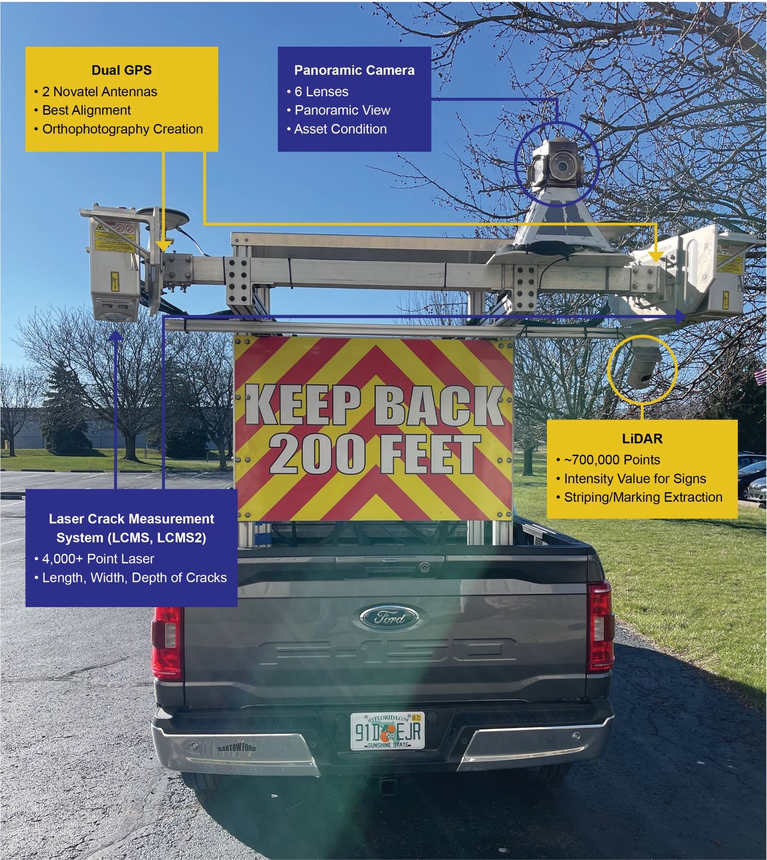
Daytona Beach is using advanced technology to assess its residential streets. Starting next week, Transmap, a road and sidewalk evaluation company, will conduct a citywide survey to inspect, document and rate pavement conditions. Using 360-degree cameras and GPS, Transmap will capture a visual record of city streets, grading each on a scale from 0 (failed) to 100 (excellent). The survey will also include sidewalks and pavement markings.
The last assessment was in 2020, and best practices recommend inspections every 3-5 years. Data collection will take about two weeks, with a final report, including web images and interactive maps, available by June. This data will be integrated into the city’s new OpenGov-Cartegraph software to streamline maintenance and future road projects.